
Using Google Earth Engine & Landsat Data to Map Urban Sprawl
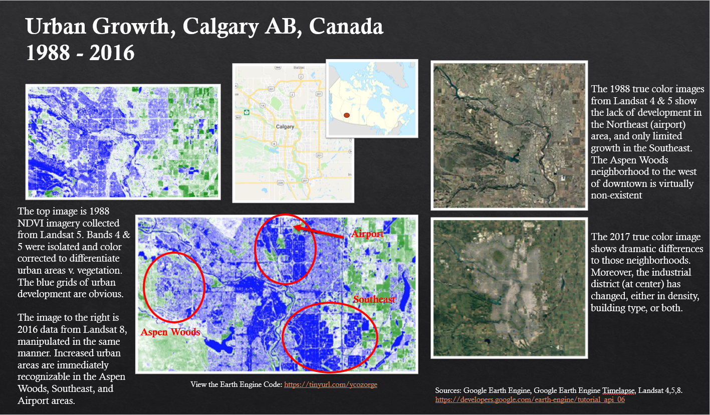
Using Google Earth Engine, and Landsat 5,4 & 8 data, I tracked growth of neighborhoods in Calgary, AB. Earth Engine allows for server-side manipulation of vast amounts of remotely sensed data, making it a powerful tool for large datasets and analysis. Learn more about Earth Engine HERE