Evaluating Wildfire Risk Areas in Western Washington State
I was named National Champion in the 2015 URISA Undergraduate GIS skills competition for this research
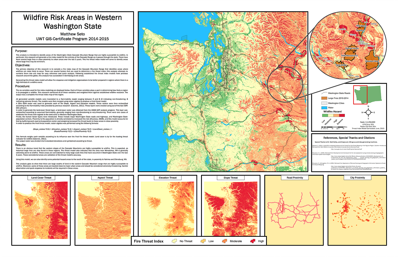
This was a submission to the 2015 URISA National GISPRO conference. I evaluated the risk areas for western Washington State for wildfire threat. Using raster data (DEMs) I generated 6 variables and weighted them appropriately to accurately identify risk areas in the research area. Please contact me for further details on this research.